Supervision
Prof. James Wescoat (Aga Khan, MIT)
The Spatial Imagination of Al-Idrīsī ’s Mediterranean
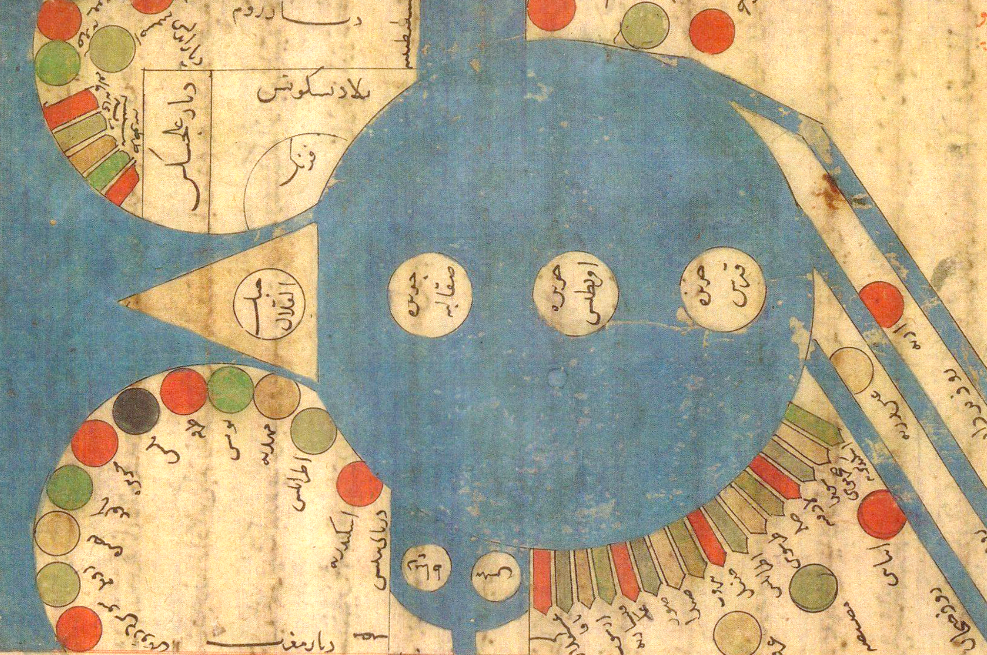
Applied image processing methods on the 1154 al-Idrīsī ’s Tabula Rogeriana
When in 1150 the Muslim polymath Muḥammad al-Idrīsī started working under the patronage of the Christian king Roger II in the Kingdom of Sicily, the Mediterranean region had not yet been fully documented by neither the Ptolemaic nor the Balkhī schools of cartographers. It is, in fact, widely acknowledged by scholars in the field that the 1154 al-Idrīsī’s Tabula Rogeriana is an unprecedented case of both cartographic accuracy and cultural representation of the Mediterranean basin. However, the act of producing such representations is never neutral, but it often takes place within specific political and historical contexts that significantly influence the map-making process.
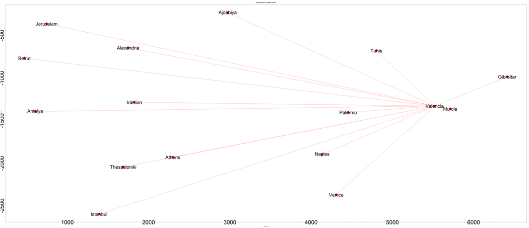
Given both the exquisite representational details of the Tabula Rogeriana and the cultural heterogeneity of Rogier’s kingdom, this study sheds light on al-Idrīsī’s perceived and represented distances across the Mediterranean. More specifically, this paper employs a series of advanced image processing tools to unpack the “hidden agenda” of cartographic distortion in al-Idrīsī’s Tabula Rogeriana and to speculate on his spatial imagination of the Mediterranean region.
The results of this analysis demonstrate that 1) in al-Idrīsī’s map geographic proximity is a function of sailing time, and 2) among a selected sample of sixteen cities in the Mediterranean basin, Palermo and Thessaloniki have the highest distortion rate. By contrast, the holy city of Jerusalem and the cultural center of Hellenistic traditions of Alexandria have the most accurate geographic positions, maintaining their reciprocal roles of religious and cultural beacons even through High Middle Age cartography.